Revival & Utilisation of Natural River Bed of Jamuari River (distributary of Burhi Gandak and tributary of Ganga)
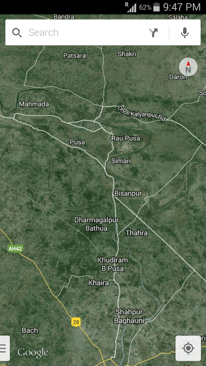
The source of Jamuari River is near Dholi Agriculture College of Muzaffarpur District in Bihar , India.
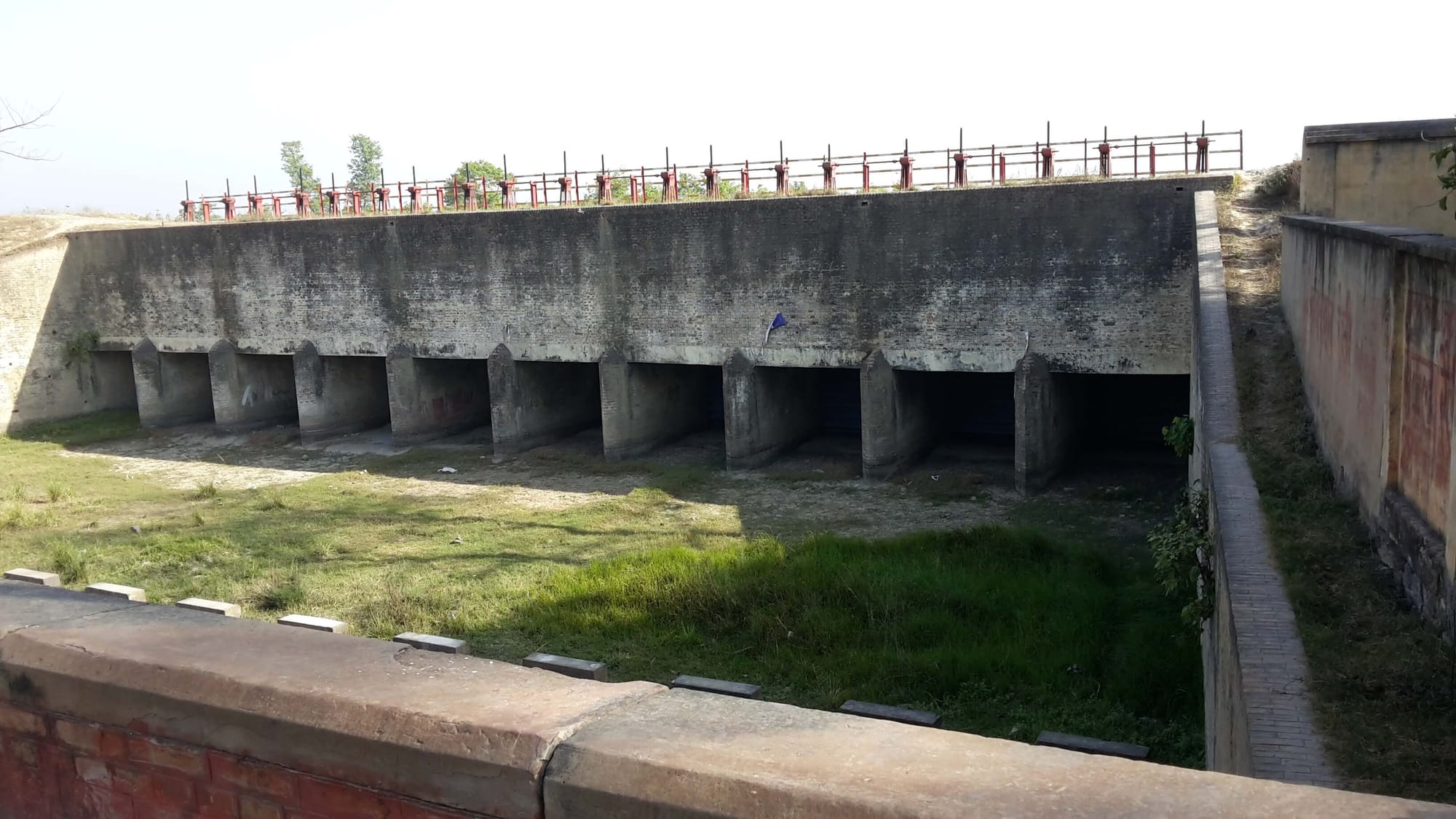
It originates from Burhi Gandak River and is guarded by 10 nos Vertical Gates made to avoid floods in Jamuari , common prior to 1965.
Burhi Gandak River , with total Catchment area of 12180 sq km and estimated water resource of 4040 M.C.M. , and with 1991-2006 data showing "above danger mark" levels in July-Sep for Muzaffarpur and Samastipur , could easily provide annually 160-170 LPS water discharge to Jamuari between Feb to June -- to cover irrigation/cattle-breeding in 5-6 Blocks or 35-40 Gram-Panchayats. Jamuari without flood conditions could easily hold 60 lakh CuM of water from Burhi Gandak.
With the shifting of Burhi Gandak a few hundred meters away some years ago , the opening of Gates of Jamuari stopped. Now, only during/after monsoons Jamuari sees water as link to Burhi Gandak , the Gates , are not required to be opened -- as river bed of Jamuari , in normal times , is about 20 feet above the Burhi Gandak water level.
During Monsoons Burhi Gandak touches the Vertical Gates for Jamuari. Thus water flow in Jamuari is seen for 2-3 months and stagnant water for another 3-4 months , every year . For about 6 months Jamuari remains dry.
Lift technology has been executed at Najimabad ( Telangna - Ali Sagar Project ) on River Godavri to raise 455 cusecs to 75 meters height , to provide for irrigation etc. In comparison , the requirement for Jamuari would be 10 cusecs to a height of 9-10 meters. Hardly a requirement of 300 H.P. Plus the area & population covered by Alisagar Project is smaller than what this meagre requirement of Jamuari would cover.
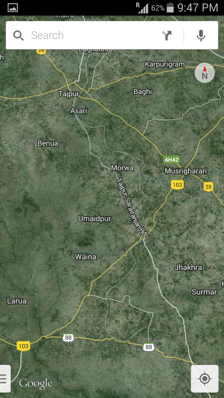
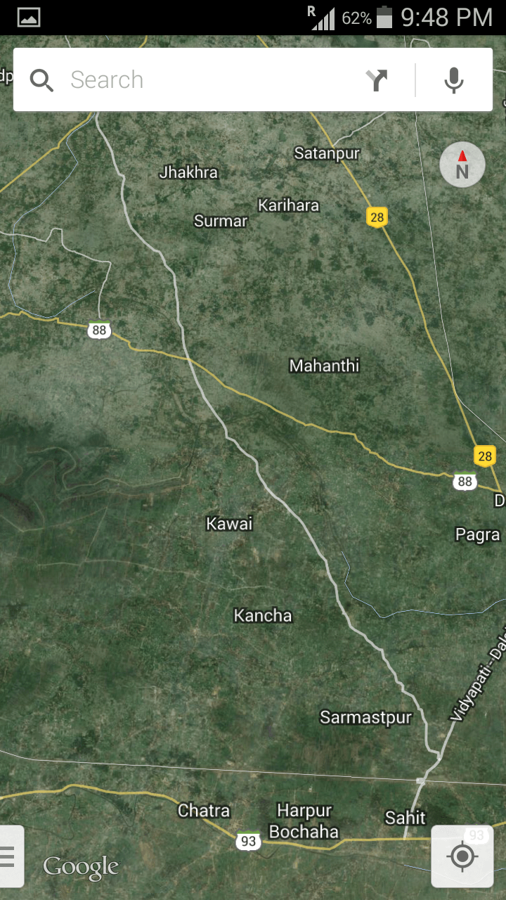
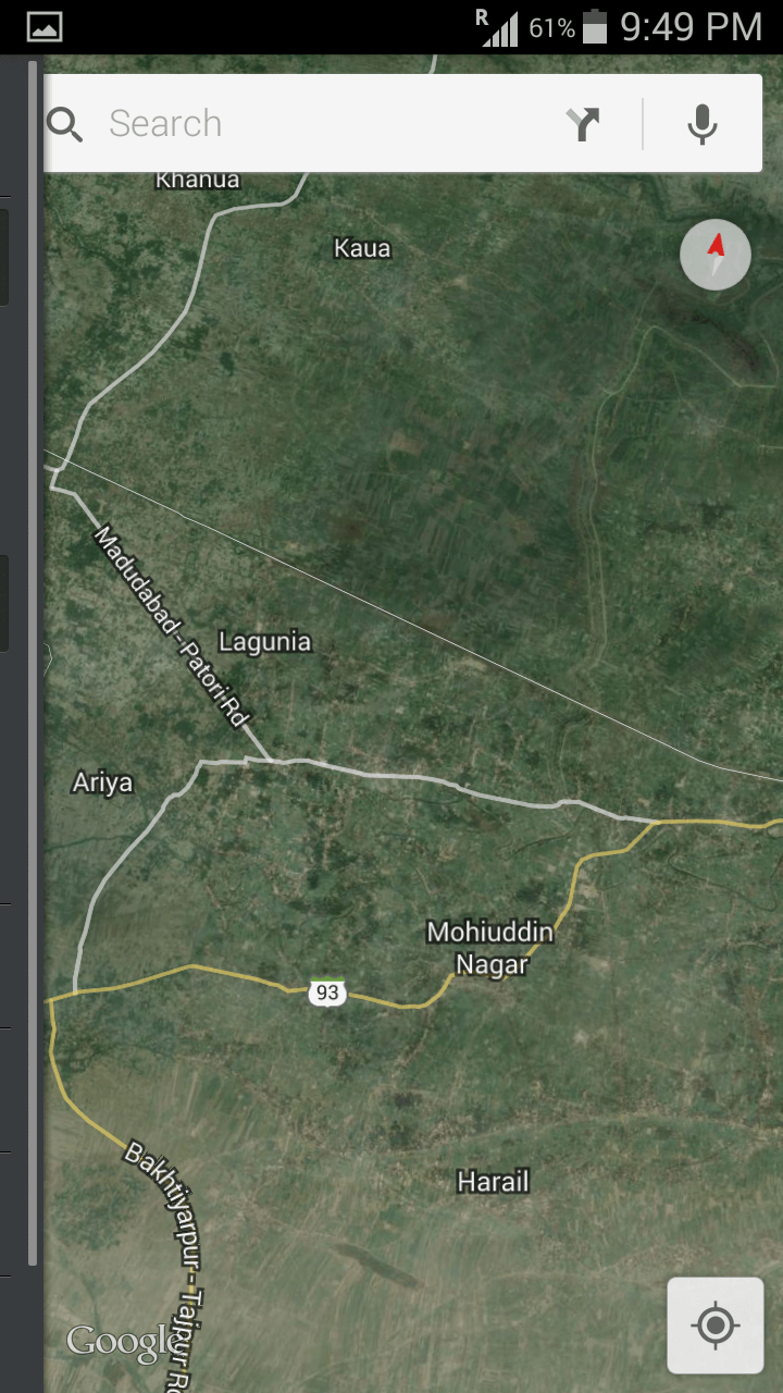
Starting from near Dholi Agriculture College , Jamuari touches Dighra-Tajpur-Morwa-Sarariranjan-Ahmedpur. Near Ahmedpur , one stream (Jamuari River) goes towards Mohaddinagar and another stream breaks off ( Bainti River) towards Dalsingsarai. From Mohaddinagar Jamuari flows South towards Harail to meet Ganga. In between , one stream coming from Larua meets Jamuari east of Kaua and one stream comes out of Jamuari towards east - to meet Ganga flowing through Harpur Bochha, Suro , Dularpur and Teghra. In Harail area , two streams coming from West ( Jamdaha Patori and Balia ) drop into Jamuari before Jamuari drops into Ganga.
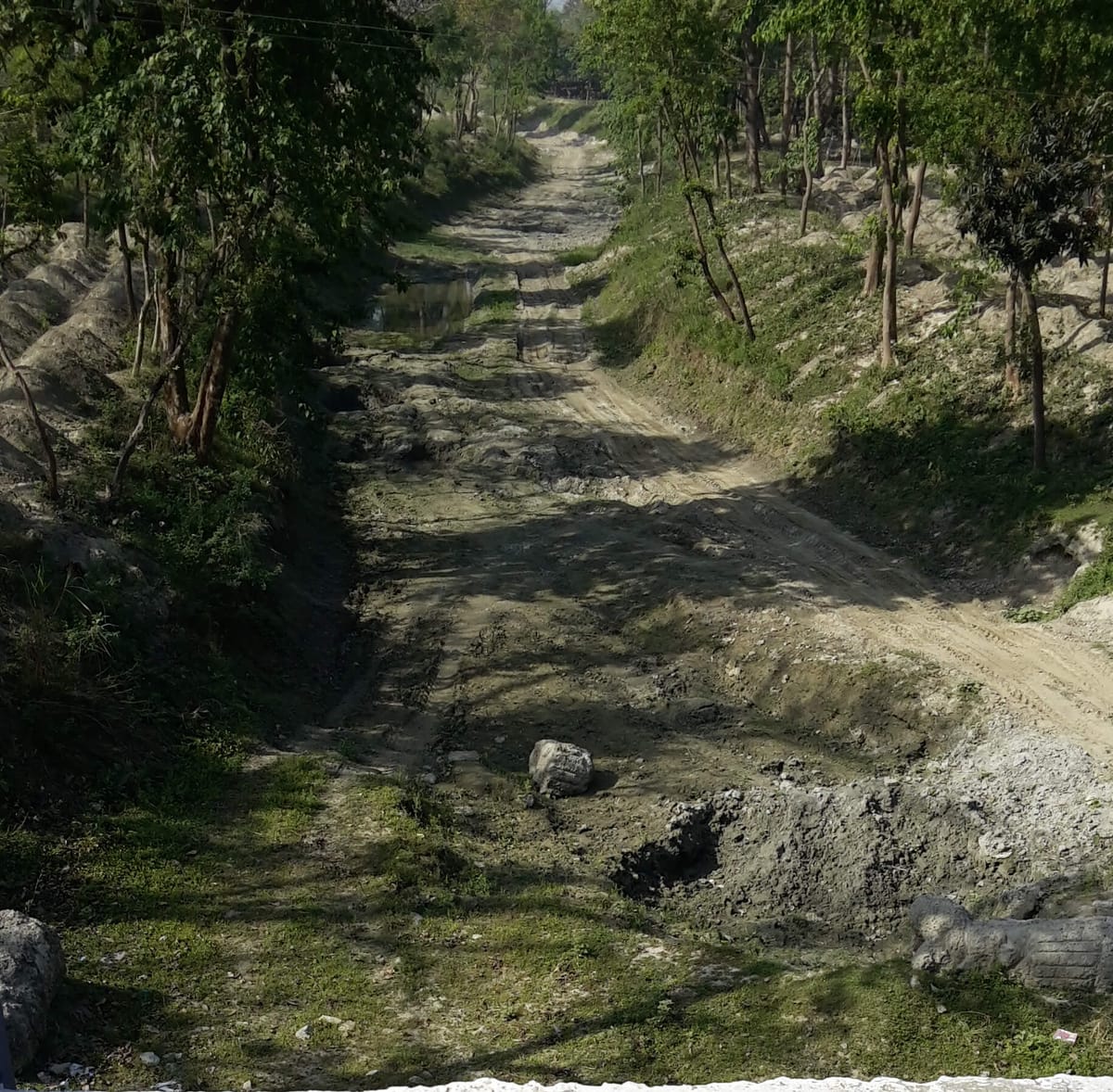
Till date no major problems of aggrading or meandering has been observed along the route. Minor aggrading problems could be tackled by Panchayat level Manrega Scheme.
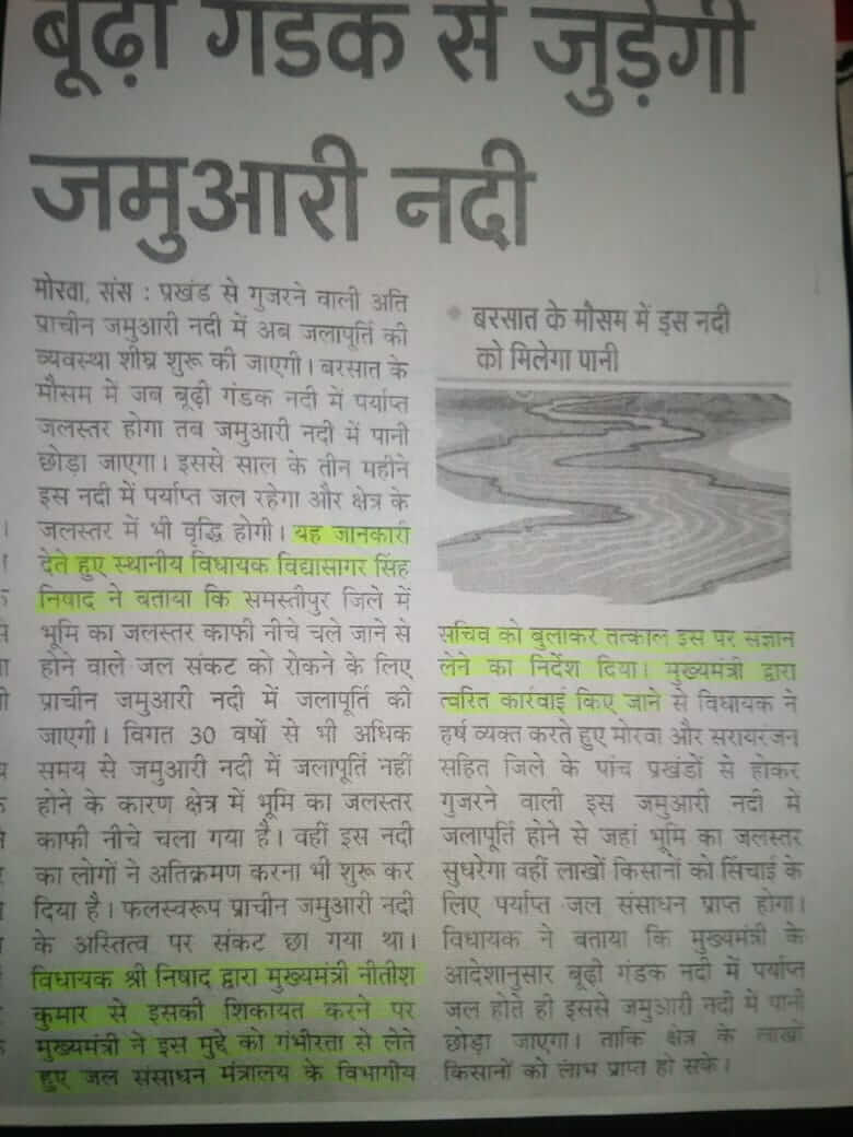
Political compulsions lead to creating new canals in clout-weilding localities and God/Nature given assets are left to waste. On raising the Jamuari issue some attention was received ( as seen from Newspaper Clippings attached below ) but nothing much has moved. Vested interests would propose making of artificial canals , as it is lucerative , but men of wisdom should prefer expenditure reduction by utiluzing gifts of nature.